View a pdf of the story as it appears in the October 2024 issue of Science Advisor.
Discovery challenges idea that ancient trade routes only linked lowland oases
More than 1000 years ago along the fabled Silk Road, caravans funneled silk and cotton west to Europe while wool, glass, gold, and silver traveled east to China. Oasis cities in Central Asia formed important nodes along these routes, which were actually a network of trading paths. Now, the surprising discovery of traces of a major medieval city at an altitude of more than 2000 meters in Uzbekistan shows the network extended far into rugged mountainous areas it was assumed to bypass. “We’ve uncovered the largest urban center at a high altitude in Central Asia,” says Michael Frachetti, a Washington University in St. Louis archaeologist and co-leader of the team that made the discovery.
“To find a city-sized settlement in this highland landscape is entirely a surprise,” says Soren Michael Sindbaek of Aarhus University, who was not involved in the work. Premodern cities at this altitude are exceedingly rare; Tiwanaku in Bolivia, Cusco in Peru, and Lhasa in Tibet are among the few known. Sindbaek says the find has “the potential to rewrite the history of Central Asia” by showing that large, transient populations of herders could sustain a city far from rich farmland. The work, reported today in Nature, also has other researchers eager to adopt the team’s pioneering survey methods, with a laser mounted on a low-flying drone.
In the past, lowland cities such as Bukhara and Samarkand in today’s Uzbekistan were thought to anchor the trade routes between Europe and China (see map, below). Although scattered across vast deserts, these cities had plentiful water and were surrounded by fertile fields. In 2011, however, Frachetti and Farhod Maksudov of the National Center of Archaeology in Samarkand stumbled on a small medieval urban area at 2100 meters in a remote part of eastern Uzbekistan. Covering a dozen hectares, the site, called Tashbulak, included stone fortifications, an area for metal and craft production, and a cemetery. Coins, pottery, and radiocarbon analysis dated it to as early as 750 C.E.
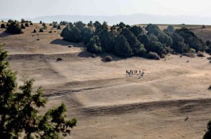
While excavating Tashbulak in 2015, the team documented a site with even more extensive ruins, 5 kilometers away and known locally as Tugunbulak. “I was skeptical in the beginning,” because the city seemed so large, Maksudov recalled. Harsh weather, rugged terrain, and the sheer scale of both sites made traditional surveys a challenge.
The team turned to lidar, which scans Earth’s surface by emitting light and measuring the time it takes to bounce back to the device. The instrument is often mounted on a plane and used to map ground contours through dense foliage. Recent technological advances, however, have made it possible to mount lidar on a low-flying drone. Starting in 2022, the team conducted 22 flights over the site, taking advantage of the sparse vegetation to collect dense, high-resolution data that show the intricacies of the surface.
“I am as surprised as most archaeologists likely will be by seeing how much detail this equipment reveals in what seems like an open grass field,” Sindbaek says. As a result, Frachetti adds, “We could tease out very nuanced lines” of architectural remains, providing precise detail on where to excavate. Since 2022, the team has conducted summer digs.
Spanning 120 hectares, Tugunbulak is more than half the size of ancient Samarkand, also called Afrasioab, one of medieval Central Asia’s largest cities. One of Tugunbulak’s four sectors includes a 30-hectare area with four large citadels that might have housed as many as 5000 residents in more than 300 structures. Walls and towers made of stone and rammed earth rose from strategic ridge lines, making a formidable redoubt.
The digs revealed evidence of a large, fortified iron foundry with domed furnaces that may have also produced steel. With plentiful iron ore from nearby deposits, Tugunbulak was a major producer and exporter of metal objects—presumably implements for riding, farming, and fighting—likely prized throughout medieval Central Asia.
Radiocarbon dating and coins suggest the site was occupied from the late sixth to the early 11th centuries, prime time for the Silk Road. During this era, eastern Iranian farmers called the Sogdians dominated Central Asian trade and cities like Samarkand, while Turkic herders from the eastern steppes were thought to live on the periphery.
Given the layout, fortifications, and artifacts, however, Frachetti thinks this mountain city reflects “an autonomous political entity” possibly outside of Sogdian control and run by pastoralist Turks. An apparent absence of structures within the fortified areas suggests residents were highly mobile, he says. He thinks they may have pitched yurts within and around the city walls in summer, then moved to warmer lowlands with their flocks in winter, a typical migration pattern for sheep and goat herders.
“This find will challenge scholars to rethink the traditional division between agricultural societies and mobile pastoralist cultures,” predicts Sanjyot Mehendale, an archaeologist at the University of California, Berkeley who recently joined the team. She says it also adds to a growing body of evidence demonstrating that the highlands developed regional and wider connections, in part by providing valuable metal for trade.
Sindbaek cautions more excavations are needed to confirm Tugunbulak was as large as it seems, rather than a smaller settlement that shifted position over time. Frachetti says this will be a goal for next summer’s digs.
Meanwhile, other archaeologists in Central Asia are eager to adopt the team’s methods. “This will transform the discussion of the nature of urban settlements throughout the region,” says Central Asian archaeologist Tim Williams of University College London. “I foresee this groundbreaking approach will spark a new wave of survey work across the region. We will certainly be applying it to our fieldwork.”
